
More Information of Choquequirao Trek
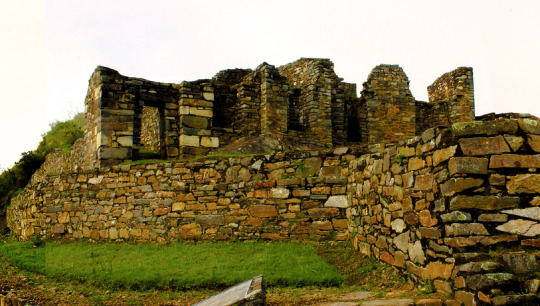
The geographical location is northeast of Cusco between the rivers of Apurimac, Urubamba and the majestic Salkantay with a maximum height of 6,271msnm and a minimum of 2,575 meters above sea level. The Vilcabamba range offers the unique opportunity of a fascinating hike between an environment of glaciers, green mountains, bears, condors, tarantulas, etc. This cloud forest region served as a refuge and natural fortress for the 16th Inca resistance movement of the 16th century, which sought to regain control of the Tahuantinsuyo from Spanish invaders. The customs and clothes typical of local people reflect a mixture of cultures. Its tongue and textiles with Inca and Pre-Inca ornaments, give clear evidence of the influence of the Quechuas. Vilcabamba is also the region where there is a concentration of Pre-Columbian archaeological treasures, including Choquequirao and the famous citadel of Machu Picchu. There is a network of operation of the Inca roads that connects the pampas of Vitcos, Rosas pata and Espiritu Pampa.


0 comments:
Post a Comment